Germany and Austria
Timmelsjoch High Alpine Road, Nockalm Road, Malta High Alpine Road, and 41 more roads.
Driving guides · 7 regions · 336 roads
A driving guide covers one region and downloads in a minute: 44 to 66 roads, each on one page with the route, the toll, when the pass opens and where to stop. Read it on your phone, print it, or send the GPX to your navigation.
The Silvretta High Alpine Road is shut until 2030 at the earliest. The Grossglockner High Alpine Road costs €46.50 a car. On the Cap de Formentor, private cars are banned from 10:00 to 22:00 between 15 May and 18 October.
Each page in these guides has done that day of checking for you, and 273 of the 336 roads cite a published source by name, so you can check it before you set off.
Edition 2027
Seven driving guides, €26.99 each. Every one is a complete download: the PDF, a page for your phone and a GPX track for every open road. Buy now and the rechecked 2027 edition follows free.
Each guide then shows how many of its roads lie within 150 km of you, straight line. Nothing is stored.
Timmelsjoch High Alpine Road, Nockalm Road, Malta High Alpine Road, and 41 more roads.
Upper Savinja and Pavličevo Sedlo, the Biokovo Road, the Sedlo Pass, and 47 more roads.
Col du Noyer, Col de l'Iseran, Col du Télégraphe and the Galibier, and 41 more roads.
Ronda Road, Velefique, Creueta Pass, and 41 more roads.
Agnello Pass, Fauniera Pass, Würzjoch, and 41 more roads.
The Wielka Pętla Bieszczadzka, Vernár and the Dobšinský kopec, Malý Šturec, and 63 more roads.
Sanetsch Pass Road, Albula Pass, Alpe di Neggia Road, and 41 more roads.
The 2027 Edition
And every guide published while the 2027 Edition is on sale. 336 roads, 10,183 km, one checkout: €11.29 a guide today.
Every guide, in the Edition or bought on its own, gets its rechecked 2027 edition free by email.
Buy all sevenWHAT YOU DOWNLOAD
01 · THE GUIDE PDF
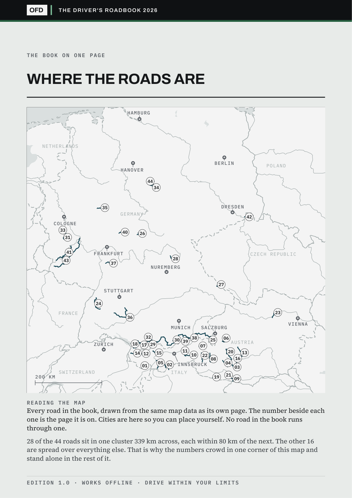
Page 2 maps every road in the guide, each with its number. On a phone, tablet or laptop every button on the page is a link; print it for the glovebox.
02 · THE START HERE PAGE
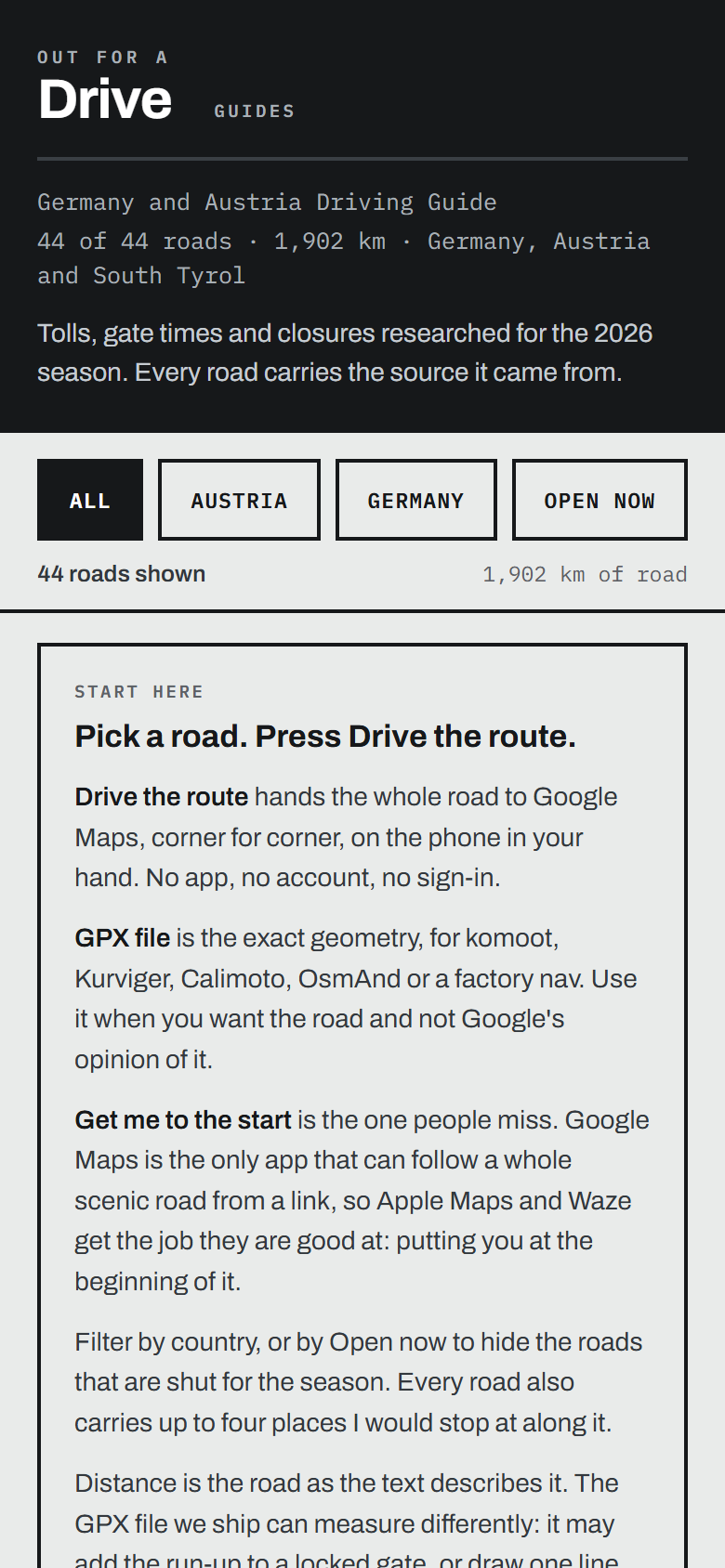
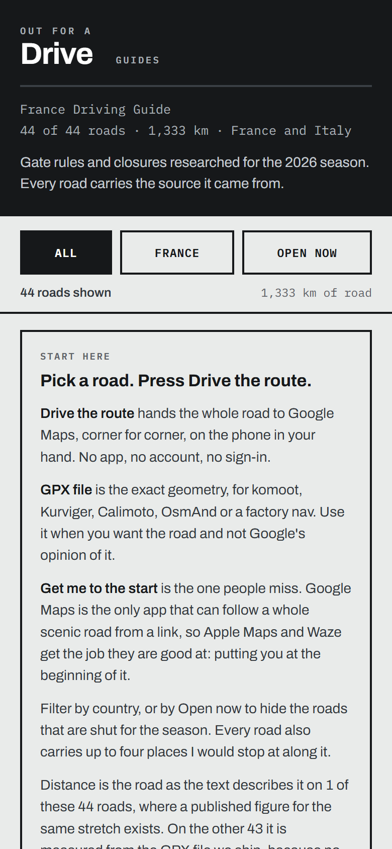
One file that opens in your phone's browser and works in a mountain valley. Type where you are and it sorts the roads by distance.
03 · GPX TRACKS
A track for every open road, and a button on each page that opens the whole road in Google Maps, and from there on CarPlay or Android Auto.
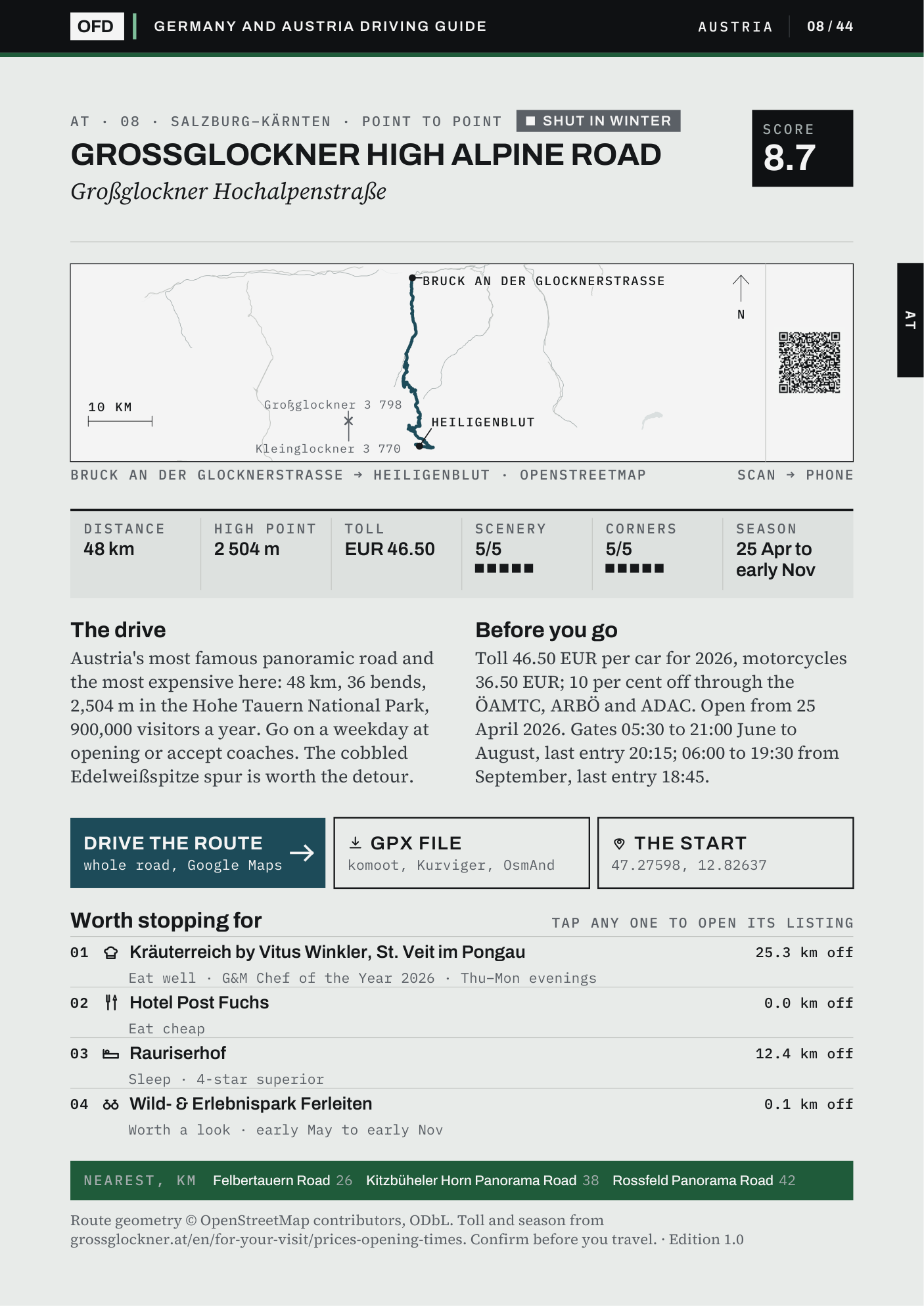
Inside a page
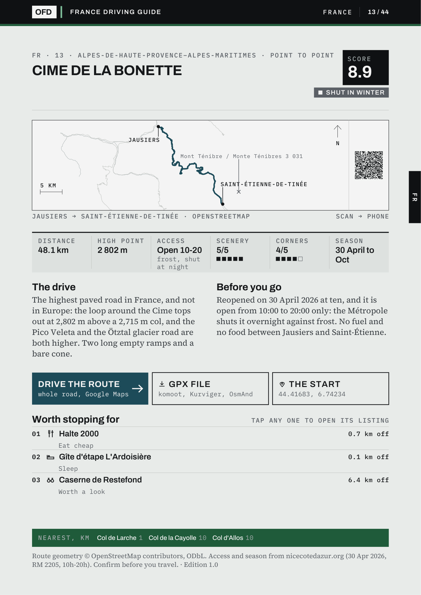
This is the page for road 08 of 44 in the Germany and Austria guide, exactly as it arrives. Every road in every guide gets a page laid out the same way.
Named in English and the local language, with a drive score out of 10 for corners, scenery and traffic; the formula is printed in the guide.
Drawn from OpenStreetMap on a quiet map, with a QR code to send it to your phone.
Distance, high point, the toll a car pays and the dates the road is open, each with the season it was read for.
What it is like to drive, gate hours, discounts and bans, with the source printed underneath.
One tap opens the whole road in Google Maps. The GPX file and the start point sit beside it.
Up to four places near the road to eat, sleep or look, each linked to its listing with the distance off the road.
Free sample
Five complete pages from the Germany and Austria guide, exactly as a buyer gets them, with the key map of all 44 roads so you can see how close they are to you.
See page 2 first: all 44 roads on one mapCard, Apple Pay or Google Pay, through Stripe. VAT is included in the price you see.
Your files are on the page you land on after paying, and the same link arrives by email in about a minute. They are yours to keep, on all of your own devices.
Save the Start Here page to your phone, load the GPX into your navigation, or tap Drive the route on any page.
Anything else: info@outforadrive.com
No. It is a download: an A4 PDF with one page per road, a Start Here page for your phone that works with no signal, and a folder of GPX tracks. Print the PDF on a home printer if you want paper.
You download the current guide the moment you pay, with every toll, gate hour and opening date as read for the 2026 season. Each is then checked again for 2027, and the rechecked edition is emailed to you free by 1 May 2027. The roads, routes and GPX tracks do not expire. Every guide, in the 2027 Edition (all seven guides in one checkout) or bought on its own, gets its rechecked edition this way.
Every page prints the road's season. Where the season has dates, the Start Here page on your phone checks today's date and says whether the road is open now, shut for winter, or which month it opens.
The roads are on every map, and the route lines here come from OpenStreetMap, which is free too. What is not free is the day it takes to find out that the Silvretta High Alpine Road is shut until 2030 at the earliest, what each road charges and when its gate closes, and which places near it are worth the stop, with any not yet confirmed marked as such. That is the work in every page, and each page says where its answers came from.
The GPX tracks load into komoot, Kurviger, Calimoto, OsmAnd and Garmin. If your car's own navigation cannot import a GPX file, tap Drive the route on the page: the whole road opens in Google Maps on your phone, and from there on CarPlay or Android Auto. Apple Maps and Waze get the start of the road.
Yes. The roads are the same on two wheels, and where an operator bars motorcycles, the road's own paragraph says so. Twelve of the 18 toll roads print the motorcycle toll beside the car's; for the others, check the operator's page.
Yes. Buy it as usual, then write to info@outforadrive.com with the name and email address of the person it is for. A download link of their own is emailed to them, the licence passes to them, and the rechecked 2027 edition goes to their address too. Fresh links from the re-download page still go to the address you paid with.
Ask for a refund within 30 days. One line is enough, and no reason is needed.
One region
One driving guide of 44 to 66 roads, with its PDF, phone page and GPX tracks.
Choose your regionAll seven · the 2027 Edition
336 roads across 15 countries, and every guide published while the 2027 Edition is on sale.
Buy all seven €79.00