The fiveThe book's own index numbers, kept
These five, and where they sit among the 44.
IdxRoadRegionLengthScoreState
FR 13Cime de la BonetteAlpes-de-Haute-Provence / Alpes-Maritimes · 48.1 kmAlpes-de-Haute-Provence / Alpes-Maritimes48.1 km8.9Open
FR 03Col du Télégraphe and the GalibierSavoie / Hautes-Alpes · 45.1 kmSavoie / Hautes-Alpes45.1 km9.3Open
FR 27Route des Crêtes du VerdonAlpes-de-Haute-Provence · 22.0 kmAlpes-de-Haute-Provence22.0 km8.2Open
FR 30Gorges de GalamusAude / Pyrénées-Orientales · 5.6 kmAude / Pyrénées-Orientales5.6 km8.2Open
FR 28Cap CanailleBouches-du-Rhône · 11.4 kmBouches-du-Rhône11.4 km8.2Open
The index numbers are the book's own, so you can see where the five sit among the 44.
01One address, nothing else asked for.
02The files open straight away, in the browser.
03Keep them. There is nothing to cancel.
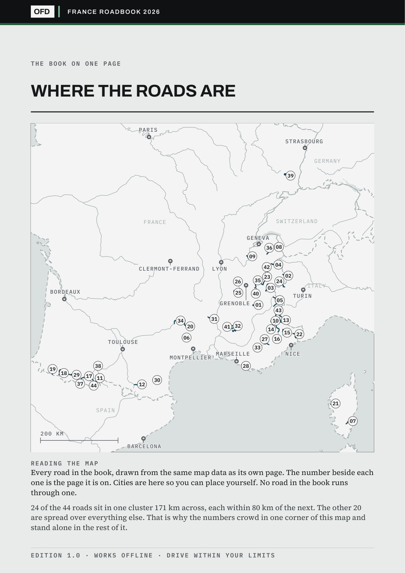
The sample carries the same key map as the paid book, so you can hold all 44 roads against where you live before paying anything.